Cerexio Logo
Address

21, Woodlands Close, #05-47 Primz Bizhub, Singapore 737854

Phone

+(65) 6762 9293

Search
Close this search box.

How can Satellite-driven Data Save Natural Resources?

How can Satellite-driven Data Save Natural Resources?

Natural resources are squandered in many countries, and the response by most national governing bodies have not sufficiently met the sustainment needs of preserving natural resources. As the interaction between environmental dynamics and natural resources keeps getting complex and unpredictable, governments have no choice but to rely on new-fangled technologies. This is why most governmental efforts have relied on out-of-the-box technologies to conserve natural resources and promptly respond to environmental emergencies. Yet, most countries are still falling behind in using the most apt technological advancements to screen away natural resources from harm and danger. One of the 10 most not-to-be-missed technologies for Water Infrastructure Management technologies used to protect environmental ecosystems is a technology literally out of this world: Satellite-driven Data Analytics. Today we are connecting with our blog readers to help you understand the twists and turns of the perspective that global leaders have on satellite data for preserving nature. This 7-minute read will help you acknowledge the importance of applying satellite data to save nature from the impacts of natural and man-made catastrophes.

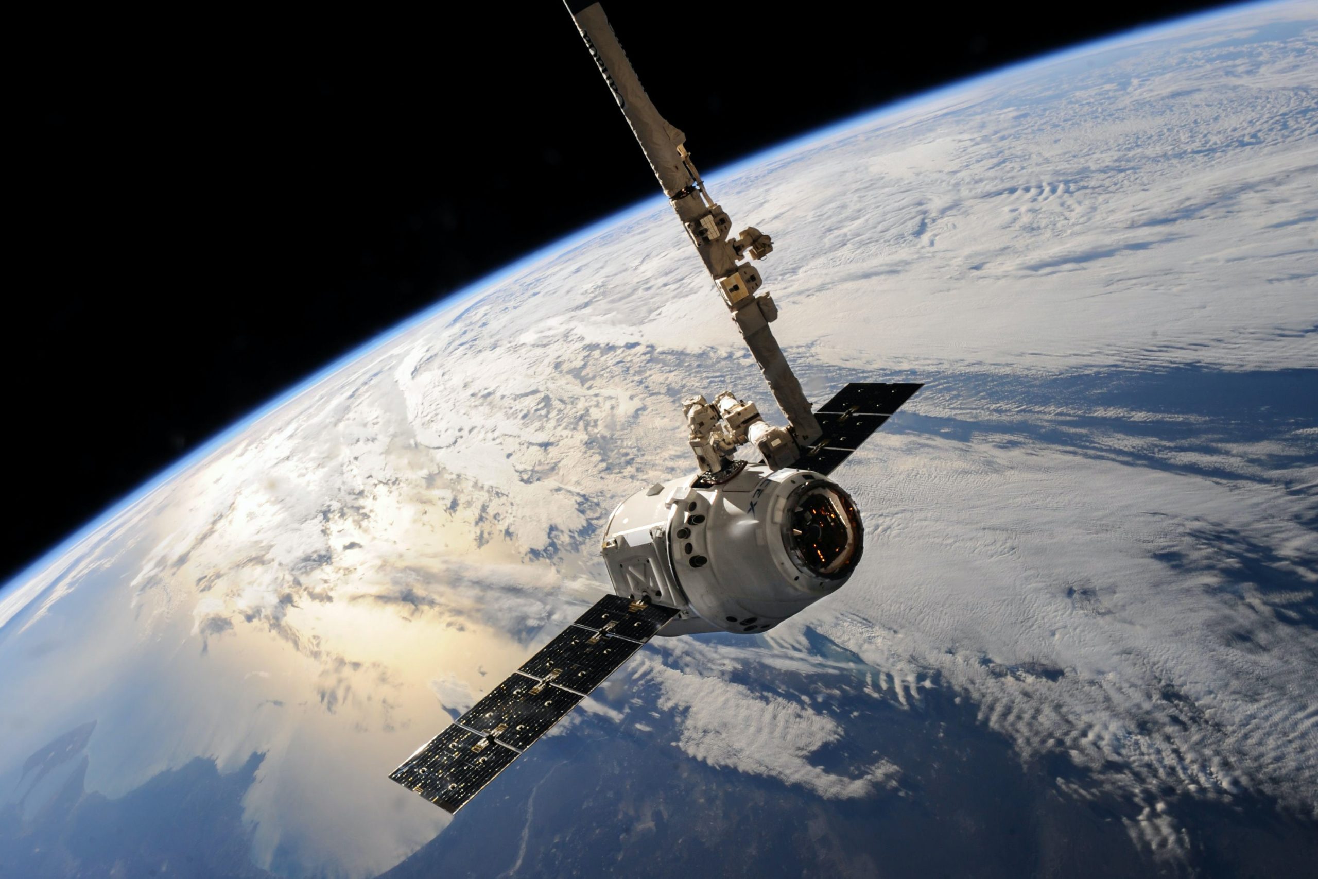
The What, How and Where of Satellite Technology

With many state organisations investing in satellite technologies, the surging dependence in the Space Industry to facilitate a plethora of industries and public interests of many developed countries has never been this crucial. These technological emergencies have heeded national governing bodies to capitalise on satellite-borne data to explore new ways to monitor and draw insightful patterns in a new reservoir of data. Satellite Data Analytics refers to the use of proprietary algorithms powered by AI to analyse big data extracted from satellites to deliver impactful and accurate strategic insights to resolve major issues in a large-scale scope. These tools sift from information, infrared data to imagery to enable bespoke solutions to worldwide problems. For example, Satellite Data Analytics can help a country diagnose the impacts of natural disasters before the occurrence of disasters, thus, giving a government enough insights to strategise disaster impact control, risk management and recovery plans to mitigate the consequences of natural disasters.
This technology uses EO (Earth Observation) Data, Scenario Analysis, Remote Sensing and Image Analytics technologies to aid in real-time monitoring and predictive advantages in many fields, like commodity market, infrastructure monitoring, business landscape monitoring and more. Out of all these purposes, one of the most fundamental technological advancements is ‘natural resource preservation’, like in occasion such as agriculture management, forestry management, pollution regulation, water quality assurance and more, which not only benefits the present but the future of biodiversity across the globe.

Some of The Main Situations Where Satellite Data Serves in Preserving Natural Resources

Even though satellite-derived data is a famous and not-to-be-missed technology for national economic growth, it plays a crucial role in safeguarding natural resources and the environment too. Here are some of the main instances satellite data plays a prominent role in safeguarding natural resources.
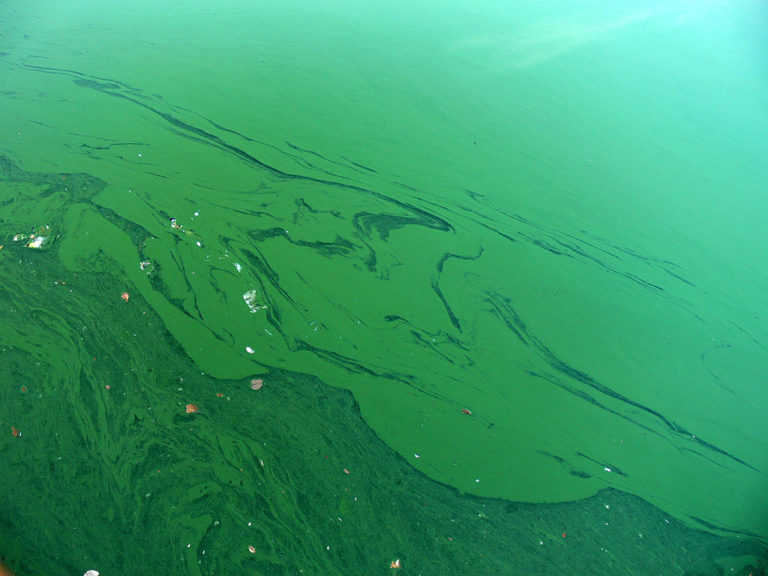
Algal Bloom Dead Zones Identification and Dispersion Prediction
HAB (or Harmful Algal Blooms) have fatally impacted the health of humans, pets and wildlife in most coastal countries. These toxic water patches can occur in brackish, salt or freshwater and dangerously impact a diversity of natural ecosystems around the world.

HABs are created due to noxious phytoplankton, cyanobacterium, macroalgae and benthic algae. Most algal blooms that are familiar to our ears are Blue-Green Algae, Red Tides and Cyanobacterial HABs. The rapid expansion of HABs has harmed a bewildering array of fishery resources, and it is important to note the natural changes, pollution, and climate shifts has caused HABs to spread like wildfire.
Thus, the need for monitoring and understanding patterns and the rate of dispersion of algal blooms are phenomenal in most shoreline regions of many countries, including Australia, New Zealand, the US and many other regions around water bodies inflicted by severe HAB threats. Monitoring the ocean colours from a satellite lens allows the satellite technology to analyse the pigment of certain types of algae and feed data to proprietary algorithms to detect harmful algal bloom variations from outer space. It uses ERGB or ‘Enhanced Optical Images’, in situ data and chlorophyll data to detect algal indexes and monitor HABs for better impact evaluation. This allows the governmental decision-makers to detect dead zones of water bodies and take precautionary measures to preserve natural resources and the public from regional and seasonal algal bloom dispersions across states, countries and continents.
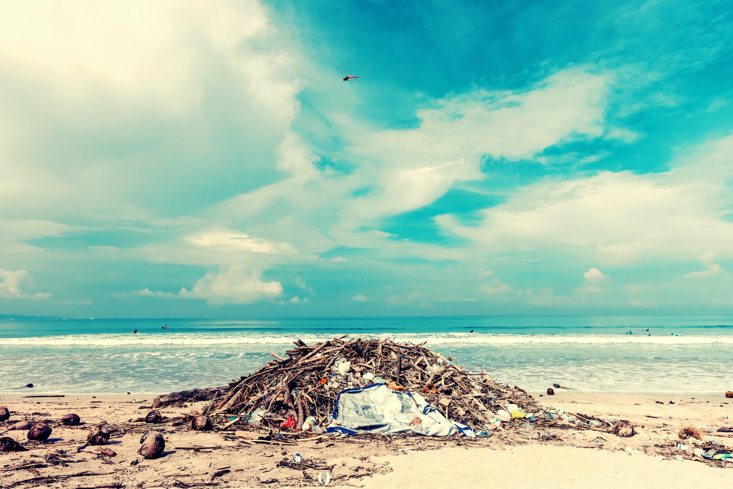
Analyse Water Pollution Criticalities from A Country-scale
The rigorous collection of ample amounts of satellite data plays the main role in detecting water pollution in most countries too. Plastic Debris crisis in maritime areas, oil and rubbish dumping in freshwater bodies, river and reservoir pollution due to floods and more can be monitored using satellite information. This technology contributes to saving a diversity of natural resources, especially the endangered coastal wildlife that are victimised and deprived of their natural habitats because of pollution.
Satellite technologies have majorly contributed to aquaculture practices with remote sensing technologies powered by satellite-borne hyperspectral sensors and in situ data that are fed into proprietary operational algorithms. Landsat, Sentinel, ASTER and EO-1 are data sets that offer a preliminary analysis of water quality and surface temperature observations of potable water bodies. This technology also allows water quality practitioners to predict pollution events and make near-real-time decisions to save ecosystems on a regional, local and global scale. All water pollution events that constitute major risks on the preservation and enrichment of nature can be sensed and controlled using GPS (Global Positioning Systems), thus enabling enough insight to validate policy formulation to warn the public in pollution-prone areas.
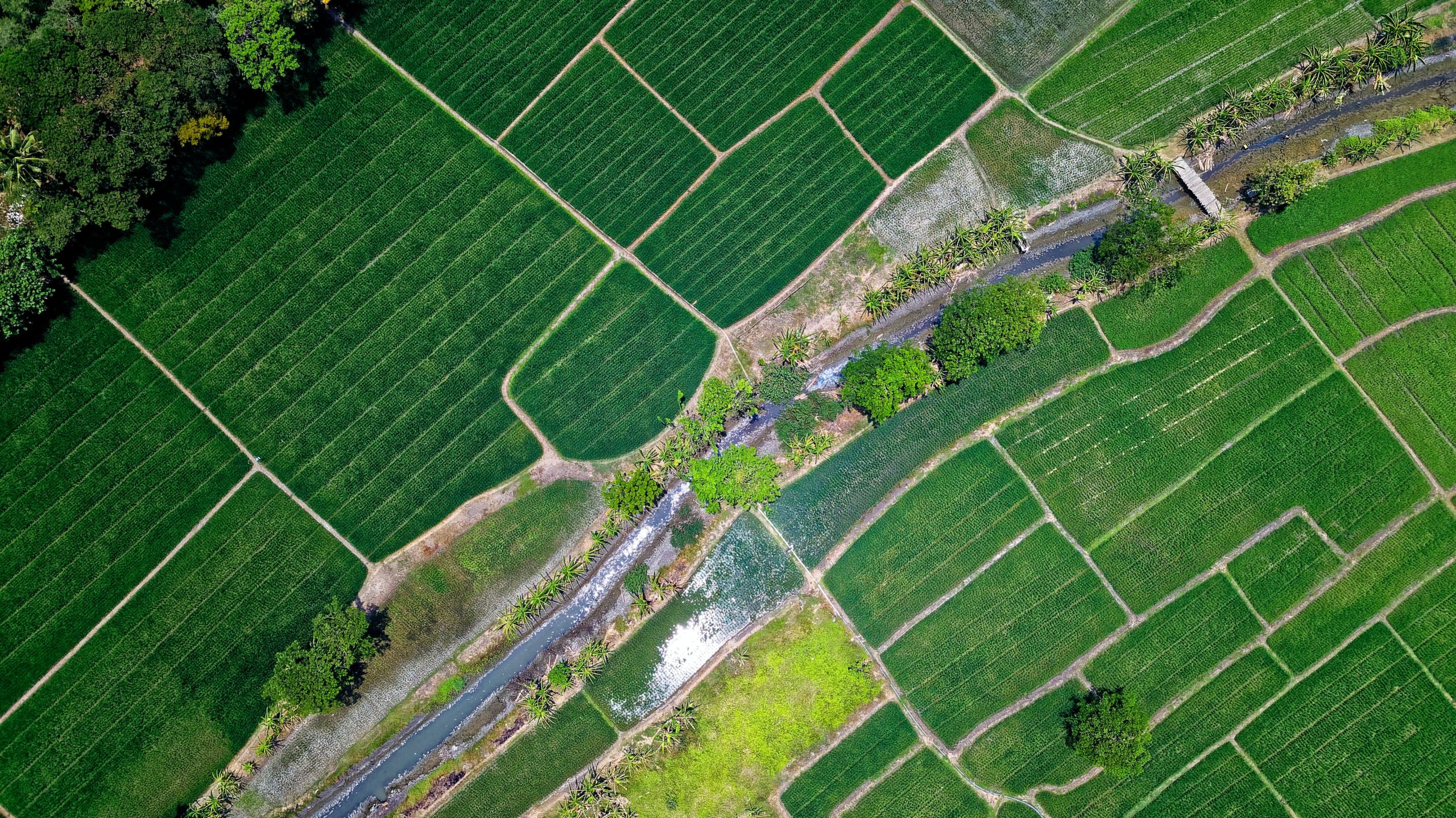
Vegetation Cover Changes Monitoring
EO data has overcome all the on-the-ground research that practitioners have done to understand the degradation of agricultural resources. With satellite technology, precision agriculture countries with massive agricultural areas covering continental landmass can save their agrarian produce in real-time. Geolocation technology, computer vision algorithms, remote sensing data are crucial in ensuring that the crops provide better yield despite the changing climatic changes and threats due to natural consequences, especially in hard-to-reach locations. It also serves in optimising agronomy decisions by giving a bird’s eye perspective of large-scale crops to detect crop patches that have more critical sustainment requirements using NDVI (Normalised Difference Vegetation Index) parametric datasets.
This technology detects the changes, health concerns and various threats imposed on agricultural resources. Governments can focus on rural areas where the public relies on natural resources to earn a living and ensure that their crops are not lost, which can have an impact not only on nature but on socioeconomic circumstances. Therefore, having automated supervision on land usages, maintenance and change over time can help countries to nurture and sustain bolstering grazing lands, fields, large-scale farms, floating farms and more.

We Are The Foremost Technology Providers to Save Nature Using Satellite Data in Singapore

Cerexio has enabled satellite-driven technologies for many countries under the concept of ‘Enriching Social and Environmental Well-being’. We have enabled a range of new-age technologies, including predictive analytics technologies to predict and mitigate risks of disasters that impact the health and security of natural resources, user-friendly EO-powered dashboards, ArcGIS interfaces, Digital Twins and Simulation Platforms powered by remote sensing and satellite imagery analytics and more. Connect with Cerexio to learn more on how we enable cutting-edge satellite-driven technologies to keep your ecosystems safe and secured.

Saving Nature from Space is An Inevitable Choice

Satellites are now the new inspectors of the sustenance, health and safety of our ecosystems; thus, learning about how they can impact countries and the world at large is very important. They are now on the journey of enabling a plethora of services to preserve natural resources around the globe; here are some more purposes that satellites meet to ensure our nature is safe and sound:

  • Assess noteworthy climatic changes that can warn impending natural disasters
  • Detection of oil pollution is water bodies inhabited by Aqualife and consumed by wildlife, pets and humans
  • Ensuring the safety, peace and conservation of wildlife corridors and national parks
  • Monitoring the health, structure and biomass of large-scale thickets of forests
  • Monitor the conservation of wetlands and oversee the usage of their natural resources
  • Pinpoint vital habitats of endangered species and control nature-harming activities in those areas
  • Provide safe navigational routes for ships to ensure the health and peace of whales
  • Supervise coastline human activities to mitigate pollution after effects and more.
  • Predicting impending natural disasters like bushfires, landslides, floods,

Thus the need for capitalising on satellite-driven data, extracted from RADARSAT, SMOS, SWOT and other satellites, to protect and monitor the resource-heavy ecosystems for the future generation is a common and innovative decision that all governments around the world will have to take in the near future. We would not be exaggerating if we say that more technological disruptions can be expected in the future with the emerging need for satellite technologies to uncover flexible solutions for the dynamic threats in future.

Search Blog Posts

Latest Blog Posts